 By Saurav Mehra
 Some junctions in Delhi are important because of what they are. Mukarba Chowk is important because of where it is — at the precise point where GT Karnal Road’s northward momentum meets the Outer Ring Road’s east-west sweep in a convergence that forces all of North Delhi’s highway and residential commuter traffic to negotiate the same junction simultaneously. Trucks from Punjab, Rohini families heading to Central Delhi employment, industrial workers from the Wazirpur belt, and the daily suburban tide from the outer northern localities — they all know Mukarba Chowk by name because they have all been stuck at it at some point.
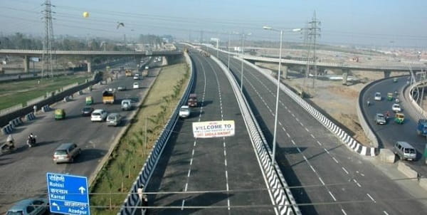
It is one of those Delhi junctions that generates strong opinions. Cab drivers discuss the best time to cross it. Rohini residents have opinions about which lane to avoid. The flyover that spans it was built for exactly the reason flyovers always get built in Delhi — the ground-level intersection had become genuinely impassable during peak hours and something had to give. The flyover gave the through-traffic its elevated bypass while the ground level continued managing the local complexity below.
| Detail | Information |
| Location | Mukarba Chowk, North Delhi |
| Type of Junction | Major Highway and Ring Road Intersection |
| Primary Road | GT Karnal Road (NH-44) / Outer Ring Road |
| Nearest Metro Station | Mukundpur — Delhi Metro Pink Line |
| Key Roads Connected | GT Karnal Road (NH-44), Outer Ring Road, Rohini Road, Shalimar Bagh Road |
| Distance from Connaught Place | Approx. 14–16 km |
| Distance from Rohini Sector 3 | Approx. 4–5 km |
| Distance from Azadpur | Approx. 3–4 km |
| Distance from Singhu Border | Approx. 8–10 km |
| Governing Authority | PWD Delhi, NHAI, DMRC |
| Nearby Landmarks | Shalimar Bagh Colony, Ashok Vihar, Lawrence Road Industrial Area |
| Public Transport Options | Delhi Metro Pink Line, DTC Bus, App Cabs, Auto-Rickshaw |
| Peak Traffic Hours | 8:00 AM – 10:30 AM and 5:30 PM – 9:00 PM |
Location
Mukarba Chowk sits at the northern end of Delhi’s Outer Ring Road arc, where NH-44 — the GT Karnal Road that has connected Delhi to Punjab and Haryana since the Mughal era — crosses the ring highway heading east toward Wazirabad and west toward Shalimar Bagh. The junction manages a traffic load that few other North Delhi intersections match. On the northern side it receives vehicles from Panipat, Karnal, and the Singhu border crossing. On the western side, Rohini’s million-plus residents use it as their primary gateway to the Ring Road. On the southern side, the highway continues toward Azadpur and the city’s commercial heart. That three-way pull makes every peak hour here an exercise in patience.
The Mukarba Chowk Flyover manages the NH-44 through-traffic, keeping the highway vehicles elevated above the chaos while the junction below handles the local turns and crossings. The system works reasonably well — which is to say, it works in a Delhi way, meaning it functions adequately under normal conditions and impressively badly when anything disrupts the routine.
Directions
From Connaught Place: Travel northward via the Outer Ring Road through Wazirpur and Ashok Vihar. Mukarba Chowk is 14 to 16 kilometres from CP, about 35 to 55 minutes in peak traffic. The Pink Line metro to Mukundpur is faster and considerably less stressful.
From Azadpur: Head northward along GT Karnal Road. Mukarba Chowk is 3 to 4 kilometres ahead, 10 to 15 minutes. The most direct southern approach from any adjacent major junction.
From Rohini: Head eastward from any of the central Rohini sectors via the sector road connectors toward GT Karnal Road. About 4 to 5 kilometres from Sector 3, 15 to 20 minutes.
From Singhu Border: Travel southward on NH-44 from the Haryana border. Mukarba Chowk arrives approximately 8 to 10 kilometres inside Delhi, around 20 to 30 minutes depending on the border crossing traffic.
From Shalimar Bagh: Head eastward from Shalimar Bagh via the colony road connecting to the Ring Road. About 3 to 4 kilometres, 10 to 15 minutes.
Metro and Public Transport Connectivity
Mukundpur Metro Station on the Pink Line is the key public transport development for this junction, placing Mukarba Chowk within reach of the Pink Line’s broad east-west arc that connects Majlis Park, Shakurpur, Punjabi Bagh, South Campus, Lajpat Nagar, and eastward toward Anand Vihar. For the large Rohini and Shalimar Bagh population, the Pink Line has added a metro option that the previously Red Line-dependent northern Delhi belt was missing. DTC buses run high-frequency services along NH-44 and the Ring Road through this junction — the route demand here is genuine and substantial, reflecting the enormous residential population that depends on this corridor daily.
Nearby Areas
Shalimar Bagh: One of North Delhi’s most well-maintained planned colonies, directly west of the chowk with wide roads and good civic infrastructure. The contrast between Shalimar Bagh’s quiet residential streets and the Mukarba junction’s intensity is one of Delhi’s more abrupt urban transitions.
Ashok Vihar: The established residential and commercial locality south of the chowk along the Ring Road, with strong local market activity and good school infrastructure serving the broader North Delhi professional family population.
Lawrence Road Industrial Area: The significant Ring Road industrial belt contributes commercial vehicle and worker traffic to the chowk’s daily load, particularly during morning hours when the shift traffic from the outer industrial zones joins the residential commuter flow from Rohini and Shalimar Bagh simultaneously.
Wazirabad: The outer North Delhi locality north of Mukarba Chowk along NH-44 is where the city’s boundary transitions toward the semi-rural fringe, and the traffic from Wazirabad’s residential and industrial zones feeds into this junction as their primary southern gateway.
Frequently Asked Questions (FAQs)
Q1. Where is Mukarba Chowk in Delhi?
North Delhi, at the intersection of GT Karnal Road (NH-44) and the Outer Ring Road, approximately 14 to 16 kilometres from Connaught Place.
Q2. Which metro serves Mukarba Chowk?
Mukundpur Station on the Delhi Metro Pink Line is the nearest, providing east-west connectivity across the northern Delhi belt.
Q3. Why is Mukarba Chowk so congested?
Three major traffic streams converge here — Punjab highway traffic on NH-44, Rohini residential commuters, and Ring Road circumferential traffic — making peak-hour congestion essentially structural rather than incidental.
Q4. How far is Mukarba Chowk from the Singhu Border?
Approximately 8 to 10 kilometres south of the Singhu Border on NH-44.
Q5. Is there a flyover at Mukarba Chowk?
Yes, the Mukarba Chowk Flyover handles the NH-44 through-traffic at an elevated level, leaving the ground intersection for local turns and residential traffic.