 By Saurav Mehra
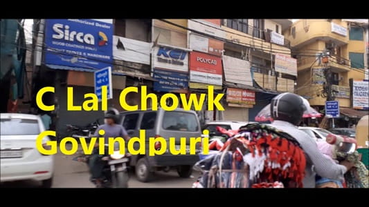
 C Lal Chowk, Govindpuri is one of the most recognisable and functionally important neighbourhood intersections in South Delhi’s Govindpuri locality, serving as the primary commercial and transit hub for one of the capital’s most densely populated and commercially active working-class residential zones. The chowk takes the name of Chhote Lal — a locally prominent figure whose name has been abbreviated to C Lal in the daily usage of the neighbourhood — and over time this shortened form has become so embedded in the local navigation vocabulary that it is the C Lal Chowk designation that residents, auto-rickshaw drivers, and shopkeepers use automatically when referencing this junction, rather than any formal street address.
Govindpuri itself is one of South Delhi’s most characteristically working-class localities — dense, commercially active, culturally vibrant, and shaped by the daily reality of a large population that depends on local employment, neighbourhood markets, and the intricate social networks of a close-knit urban community. The colony is famous in Delhi’s cultural consciousness as one of the neighbourhoods immortalised in narratives of working-class Delhi life, and C Lal Chowk is the commercial and social axis around which that neighbourhood life rotates most visibly. The market activity at the junction serves the daily practical needs of a very large residential population — vegetables, groceries, clothing, mobile repair, coaching institutes, medical clinics — with the pragmatic efficiency of a neighbourhood market that exists because it is needed rather than because it was designed. For the working families, small traders, students, and daily wage workers whose lives are organised around this junction, C Lal Chowk is the daily constant that anchors commercial and social life in one of South Delhi’s most densely inhabited urban communities.
Overview Table
| Detail | Information |
| Location | C Lal Chowk, Govindpuri, South Delhi |
| Type of Junction | Neighbourhood Commercial Intersection / Working-Class Community Hub |
| Primary Road | Govindpuri Main Road / C Lal Chowk Road |
| Nearest Metro Station | Govind Puri — Delhi Metro Violet Line |
| Key Roads Connected | Govindpuri Main Road, Kalkaji Road, Tughlakabad Road, Okhla Road |
| Distance from Connaught Place | Approx. 14–16 km |
| Distance from Nehru Place | Approx. 4–5 km |
| Distance from Kalkaji | Approx. 2–3 km |
| Distance from AIIMS | Approx. 8–10 km via Ring Road |
| Governing Authority | South Delhi Municipal Corporation, PWD Delhi, DMRC |
| Nearby Landmarks | Govindpuri Market, Kalkaji Temple vicinity, Tughlakabad Fort Road |
| Public Transport Options | Delhi Metro Violet Line, DTC Bus, App Cabs, Auto-Rickshaw |
| Best Suited For | South Delhi Govindpuri working-class residential corridor daily traffic |
| Peak Traffic Hours | 9:00 AM – 11:30 AM and 5:30 PM – 9:30 PM |
Location of C Lal Chowk
C Lal Chowk is positioned within the Govindpuri locality of South Delhi, at the junction of Govindpuri Main Road and the internal arterials that connect this dense residential colony to the Kalkaji Road, the Violet Line metro corridor, and the broader South Delhi road network. Govindpuri is situated between Kalkaji and Tughlakabad, in a zone that captures the working-class residential energy of South Delhi’s inner belt with particular intensity. The chowk sits at the commercial heart of the colony’s most active market zone, surrounded by the dense streetscape of shops, vendor stalls, service businesses, and the organised commercial chaos of a neighbourhood market that serves several hundred thousand people within walking distance.
Directions to C Lal Chowk
From Connaught Place: Travel southward from Connaught Place via Mathura Road or the Outer Ring Road heading toward the Kalkaji and Govindpuri zone. Continue through the southern Delhi commercial corridors approximately 14 to 16 kilometres from Connaught Place with a travel time of 35 to 55 minutes through South Delhi’s arterial road network.
From Govind Puri Metro Station: Exit Govind Puri Metro Station on the Violet Line and travel a short distance via the connecting roads toward the C Lal Chowk commercial zone. The junction is within very easy walking or auto-rickshaw distance from the station exit, making this the most practical approach for commuters using the metro to access Govindpuri’s commercial belt.
From Nehru Place: Travel southward from Nehru Place commercial complex via the connecting roads toward the Govindpuri zone. C Lal Chowk is approximately 4 to 5 kilometres from Nehru Place with a travel time of 15 to 25 minutes through South Delhi’s residential road network.
From Kalkaji: Travel southward from Kalkaji’s commercial and residential zone via the Kalkaji Road heading toward Govindpuri. C Lal Chowk is approximately 2 to 3 kilometres from Kalkaji with a travel time of 10 to 15 minutes — one of the most direct and frequently used approaches from any immediately adjacent locality.
From Badarpur: Travel northward from Badarpur via Mathura Road heading toward the South Delhi commercial belt. Continue through the Tughlakabad zone and approach Govindpuri from the southeastern direction approximately 5 to 7 kilometres from Badarpur with a travel time of 15 to 25 minutes.
Metro and Public Transport Connectivity
Govind Puri Metro Station on the Delhi Metro Violet Line is the single most important public transport feature for C Lal Chowk, sitting within very close proximity of the commercial junction and connecting this South Delhi working-class zone to the full Violet Line corridor. The Violet Line connects Govind Puri northward through Kalkaji Mandir, Nehru Place, Lajpat Nagar, and all the way to Kashmere Gate in Central Delhi, and southward toward Faridabad via Badarpur — providing Govindpuri’s enormous daily commuter population with fast and reliable metro access to employment centers across Delhi and the southern NCR. The metro’s arrival transformed the daily commuting experience for Govindpuri’s working-class population in a manner that is felt most directly at the C Lal Chowk commercial hub, where morning and evening metro peak traffic adds a substantial transit dimension to the junction’s commercial activity. DTC buses serve multiple routes through the Govindpuri Main Road, and auto-rickshaws and shared tempos provide the primary intra-Govindpuri movement throughout the day.
Road Connectivity
- Govindpuri Main Road runs through the colony’s primary commercial spine connecting the chowk to the Kalkaji junction northward and Tughlakabad southward.
- Kalkaji Road connects northward toward the Kalkaji temple zone and the broader South Delhi commercial belt.
- Tughlakabad Road extends southward toward the Tughlakabad residential and heritage zone.
- Okhla Road provides eastward connectivity toward Okhla’s industrial and residential belt.
Nearby Areas and Neighbourhoods
Govindpuri Market: The dense commercial market zone immediately surrounding C Lal Chowk is one of South Delhi’s most characteristically working-class neighbourhood markets, offering a comprehensive range of daily essentials, clothing, electronics, and street food at the accessible price points that serve a large lower-middle and working-class residential population efficiently and honestly.
Kalkaji: One of South Delhi’s most important residential and religious localities, Kalkaji is directly accessible from C Lal Chowk and is famous for the revered Kalkaji Mandir — a significant Hindu temple drawing large numbers of devotees, particularly during Navratri — whose presence adds a religious dimension to this part of South Delhi’s daily commercial movement.
Tughlakabad: The historically significant zone housing the ruins of Tughlakabad Fort — one of Delhi’s most impressive medieval fortifications built during the Tughlaq dynasty — is accessible from the Govindpuri zone and represents a genuine heritage asset within comfortable proximity of C Lal Chowk’s everyday commercial bustle.
Sangam Vihar: One of Delhi’s largest and most densely populated unauthorised colonies, Sangam Vihar lies in the broader Govindpuri catchment zone and contributes a very substantial population to the commercial activity of C Lal Chowk’s market ecosystem.
Alaknanda: A well-established and relatively upscale South Delhi residential colony accessible from the Govindpuri zone, Alaknanda offers a residential counterpoint to Govindpuri’s working-class character and contributes a more affluent consumer segment to the commercial activity of the broader C Lal Chowk catchment.
Frequently Asked Questions (FAQs)
Q1. Where is C Lal Chowk located in Govindpuri Delhi?
C Lal Chowk is in the Govindpuri locality of South Delhi, approximately 14 to 16 kilometres from Connaught Place, near the Govind Puri Metro Station on the Violet Line.
Q2. Which metro station serves C Lal Chowk Govindpuri?
Govind Puri Metro Station on the Delhi Metro Violet Line is directly adjacent to the chowk, providing immediate metro access to the Violet Line corridor connecting Central Delhi and Faridabad.
Q3. How far is C Lal Chowk from Nehru Place?
Nehru Place is approximately 4 to 5 kilometres from C Lal Chowk via the South Delhi road network, accessible in 15 to 25 minutes.
Q4. What is the main market activity at C Lal Chowk?
Govindpuri’s dense neighbourhood market surrounding the chowk offers daily essentials, clothing, street food, and neighbourhood services for the large working-class residential population of the surrounding colony.
Q5. Is Kalkaji Mandir accessible from C Lal Chowk?
Yes, Kalkaji Mandir is approximately 2 to 3 kilometres from C Lal Chowk via the Kalkaji Road connector, accessible within 10 to 15 minutes.