 By Saurav Mehra
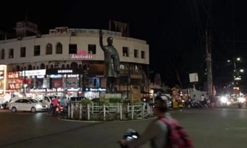
 Jabalpur sits in that interesting category of Indian cities that are important without being famous — a city that most educated Indians know exists but could not precisely place on a map, yet which is the divisional headquarters of one of Madhya Pradesh’s most historically and strategically significant regions, home to the Narmada’s most spectacular gorge at Bhedaghat, and a major railway junction on the Howrah-Mumbai mainline that has shaped its commercial character for over a century. Rajiv Gandhi Chowk is the junction that anchors the daily commercial life of this underappreciated city’s central commercial belt.
Named after the former Prime Minister in the post-1991 tradition of civic naming that swept through India’s cities following Rajiv Gandhi’s assassination, the chowk has accumulated several decades of daily urban use and now functions as one of the city’s most recognizable navigation landmarks. Jabalpur’s commercial culture has a different texture from either the fast-moving industrial cities of Maharashtra or the agricultural trading cities of the Gangetic plain — it is a government and military city at its core, with a High Court bench, a significant defence establishment, and the administrative gravity of a division headquarters shaping its residential and commercial demographics in ways that make daily commercial junctions like this one serve a specific professional and institutional population.
| Detail | Information |
| Location | Rajiv Gandhi Chowk, Jabalpur, Madhya Pradesh |
| Type of Junction | Central Commercial Intersection / City Hub |
| Primary Road | Russell Chowk Road / South Civil Lines Connector |
| Nearest Railway Station | Jabalpur Railway Station — Approx. 3–5 km |
| Nearest Airport | Dumna Airport, Jabalpur — Approx. 20–22 km |
| Key Roads Connected | Russell Chowk Road, South Civil Lines Road, Napier Town Road, Gorakhpur Road |
| Distance from Russell Chowk | Approx. 2–3 km |
| Distance from Bhedaghat | Approx. 22–25 km |
| Distance from Nagpur | Approx. 295 km via NH-44 |
| Distance from Bhopal | Approx. 320 km via NH-45 |
| Governing Authority | Jabalpur Municipal Corporation, MP PWD |
| Nearby Landmarks | South Civil Lines commercial belt, High Court vicinity, Gorakhpur Market |
| Public Transport Options | MP SRTC Bus, City Bus, App Cabs, Auto-Rickshaw |
| Peak Traffic Hours | 9:30 AM – 12:30 PM and 5:00 PM – 8:30 PM |
Location
Rajiv Gandhi Chowk is in the central commercial belt of Jabalpur, at a junction connecting the South Civil Lines residential and institutional zone to the broader city road network. Civil Lines in Jabalpur carries the particular gravity of former British administrative zones across Indian cities — wide roads, bungalow-era architecture, the presence of courts and government offices — and the chowk that connects this zone to the city’s commercial activity occupies a transitional position between institutional and commercial Jabalpur that gives it a distinctive daily character.
Directions
From Jabalpur Railway Station: Exit the station and travel southward via the connecting roads toward the city’s central commercial and institutional belt. Rajiv Gandhi Chowk is approximately 3 to 5 kilometres from the station with a travel time of 15 to 25 minutes through the moderately congested central Jabalpur roads.
From Dumna Airport: Travel westward from the airport toward the city via the airport approach road. Continue into the central zone approximately 20 to 22 kilometres from the airport with a travel time of 35 to 50 minutes. App cabs from the airport are well-supplied.
From Russell Chowk: Russell Chowk is Jabalpur’s most famous and historically significant central junction. From there, travel southward toward the Civil Lines zone — Rajiv Gandhi Chowk is approximately 2 to 3 kilometres away, 10 to 15 minutes.
From Bhedaghat: Travel westward from the Narmada gorge town into Jabalpur via the Bhedaghat Road. Continue toward the central commercial zone approximately 22 to 25 kilometres from Bhedaghat with a travel time of 35 to 50 minutes.
From Katni: Travel southward from Katni along NH-34 heading toward Jabalpur. Continue approximately 85 kilometres through the Mahakoshal highway corridor and into the city’s central zone. Travel time is approximately 90 to 120 minutes.
Public Transport Connectivity
Jabalpur relies on MP SRTC buses, private city buses, and auto-rickshaws for daily urban mobility. The city does not have metro rail, but the railway station’s centrality to Jabalpur’s geography means that trains are practically useful for intercity movement in a way that supplements the road-based city transport efficiently. MP SRTC connects Jabalpur to Bhopal, Nagpur, Indore, and other MP and neighboring state destinations. City buses serve the South Civil Lines and Napier Town corridors connecting the chowk to the station zone and other commercial areas. Auto-rickshaws are the primary intra-city mode and are abundantly available throughout the central commercial belt. App-based cab adoption has been growing steadily among the city’s professional population.
Nearby Areas
South Civil Lines: The institutional residential belt directly adjacent to the chowk houses Jabalpur’s legal community near the High Court bench, senior government officers, and the kind of professional residential population whose daily commercial needs are served by the establishments around Rajiv Gandhi Chowk with a slightly more formal, service-oriented character than the busier wholesale market zones.
Napier Town: One of Jabalpur’s most established and commercially active older localities, Napier Town is connected to the chowk via the connecting road network and offers a denser commercial experience complementing the more orderly institutional character of the Civil Lines zone.
Gorakhpur Market: An important commercial market zone in the broader Jabalpur commercial belt, Gorakhpur is accessible from Rajiv Gandhi Chowk and contributes wholesale and retail activity to the daily commercial circulation of this part of the city.
Bhedaghat Road Corridor: The road leading toward Bhedaghat’s Narmada gorge and the Dhuandhar waterfall — one of Madhya Pradesh’s most spectacular natural landmarks — is accessible from the Rajiv Gandhi Chowk zone, making this junction part of the tourism approach route to one of the region’s most visited heritage sites.
Frequently Asked Questions (FAQs)
Q1. Where is Rajiv Gandhi Chowk in Jabalpur?
A: Central Jabalpur, in the South Civil Lines zone, approximately 3 to 5 kilometres from Jabalpur Railway Station.
Q2. How far is Rajiv Gandhi Chowk from Bhedaghat?
A: About 22 to 25 kilometres via the Bhedaghat Road, taking 35 to 50 minutes.
Q3. Is there metro connectivity at Rajiv Gandhi Chowk Jabalpur?
A: Jabalpur does not have a metro. MP SRTC buses, city buses, auto-rickshaws, and app-based cabs serve this junction.
Q4. How far is Rajiv Gandhi Chowk from Russell Chowk?
A: Approximately 2 to 3 kilometres, accessible in 10 to 15 minutes.
Q5. How far is Jabalpur from Bhopal via Rajiv Gandhi Chowk?
A: Bhopal is approximately 320 kilometres from Jabalpur via NH-45, with a travel time of approximately 5 to 6 hours.