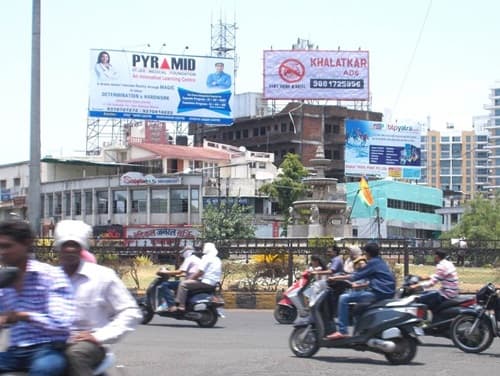
Medical Chowk, Nagpur is one of the most important and heavily referenced urban intersections in the Orange City, taking its name from the Government Medical College and Hospital — one of Maharashtra’s oldest and most prestigious medical education and healthcare institutions — that has anchored the identity of this part of central Nagpur for well over a century. The chowk sits at the heart of Nagpur’s most significant medical and institutional corridor, in a zone where the daily movement of patients, doctors, medical students, hospital staff, government employees, and the residential communities of the surrounding localities creates one of the city’s most consistently busy and functionally critical daily traffic scenarios.
Nagpur’s position as Maharashtra’s second capital and the geographic center of India gives the city a particular administrative and institutional gravitas, and Medical Chowk sits within this institutional belt with a confidence that comes from genuine functional importance. The surrounding area is a genuine medical hub in the fullest sense — not just Government Medical College and Hospital but a cluster of private hospitals, medical colleges, pharmaceutical suppliers, diagnostic centers, medical equipment shops, and the dense commercial ecosystem that grows up wherever a major medical institution establishes itself in an Indian city. For patients traveling from across the Vidarbha region and beyond seeking specialist care, for medical students from Maharashtra and neighboring states who have made Nagpur their academic home, and for the large residential population of the surrounding localities, Medical Chowk is a daily landmark whose smooth functioning has consequences that extend well beyond ordinary traffic management.
| Detail | Information |
| Location | Medical Chowk, Central Nagpur, Maharashtra |
| Type of Junction | Medical Institutional Intersection / Central City Hub |
| Primary Road | Medical Square Road / Amravati Road Connector |
| Nearest Railway Station | Nagpur Railway Station — Approx. 3–5 km |
| Nearest Airport | Dr. Babasaheb Ambedkar International Airport — Approx. 8–10 km |
| Key Roads Connected | Amravati Road, Medical Square Road, Wardha Road Connector, Seminary Hills Road |
| Distance from Nagpur City Centre | Approx. 3–4 km |
| Distance from Zero Mile | Approx. 4–5 km |
| Distance from Wardha Road IT Zone | Approx. 8–10 km |
| Governing Authority | Nagpur Municipal Corporation, NHAI, Maharashtra PWD |
| Nearby Landmarks | GMCH Nagpur, Indora Market, Government Dental College |
| Public Transport Options | Nagpur Metro, MSRTC Bus, City Bus, App Cabs, Auto-Rickshaw |
| Best Suited For | Central Nagpur medical corridor and institutional zone traffic |
| Peak Traffic Hours | 8:30 AM – 11:30 AM and 5:00 PM – 9:00 PM |
Location of Medical Chowk
Medical Chowk is geographically positioned in central Nagpur at the junction of the Medical Square Road and the arterials connecting toward Amravati Road, Seminary Hills, and the broader central institutional belt of Maharashtra’s second capital. The Government Medical College and Hospital — established in 1947 and one of the most important public healthcare facilities in all of Vidarbha — sits as the defining institutional landmark of this zone, giving the chowk its name and its fundamental identity. The surrounding area reflects the multi-layered character of Nagpur’s central institutional belt — medical colleges, government offices, residential localities, and the commercial establishments that serve both the institutional population and the daily needs of the dense residential communities of this well-established central city zone.
Directions to Medical Chowk
From Nagpur Railway Station: Exit the station and travel northwestward via the connecting arterials heading toward the city’s central institutional belt. Medical Chowk is approximately 3 to 5 kilometres from the station with a travel time of 15 to 25 minutes through Nagpur’s moderately congested central road network.
From Dr. Babasaheb Ambedkar International Airport: Exit the airport and take the airport approach road heading toward the city via the Wardha Road corridor. Continue northward into the central city zone and approach Medical Chowk approximately 8 to 10 kilometres from the airport with a travel time of 20 to 35 minutes.
From Zero Mile: Travel northwestward from Nagpur’s famous geographic center marker along the connecting arterials heading toward the medical institutional belt. Medical Chowk is approximately 4 to 5 kilometres from Zero Mile with a travel time of 15 to 20 minutes.
From Wardha Road IT Zone: Travel northward from Nagpur’s emerging IT corridor along Wardha Road heading toward the central city. Continue through the southern city zones and approach Medical Chowk approximately 8 to 10 kilometres from the IT zone with a travel time of 20 to 35 minutes.
From Amravati: Travel southeastward from Amravati along the Amravati-Nagpur Highway heading toward the city. Enter Nagpur from the northwestern approach and head toward the central medical institutional belt. Medical Chowk is approximately 150 kilometres from Amravati with a total travel time of approximately 2.5 to 3 hours.
Metro and Public Transport Connectivity
Nagpur Metro — one of the newer metro rail systems in India’s tier-2 cities — has been actively expanding its network across the Orange City, and the Medical Chowk zone falls within the broader metro catchment area with accessible stations connecting this institutional belt to the broader Nagpur urban network. MSRTC buses and Nagpur city buses operate multiple routes through the Medical Square Road corridor, connecting the chowk to Nagpur Railway Station, the central bus stand, and residential zones across the city. Auto-rickshaws are the dominant intra-city short-trip mode throughout Nagpur’s commercial and residential zones, and app-based cabs serve the professional, medical, and student population for longer cross-city journeys.
Road Connectivity
- Amravati Road extends northwestward toward the Amravati highway corridor.
- Medical Square Road provides the primary institutional spine connectivity within the immediate zone.
- Seminary Hills Road connects toward the prestigious Seminary Hills residential zone.
- Wardha Road Connector links the chowk toward Nagpur’s southern IT and commercial corridor.
Nearby Areas and Neighbourhoods
Government Medical College and Hospital (GMCH): One of Maharashtra’s oldest and largest public medical facilities, GMCH Nagpur serves as the primary referral hospital for the entire Vidarbha region and is the institutional anchor that gives Medical Chowk its identity, drawing patients, medical students, and healthcare professionals from across eastern Maharashtra daily.
Government Dental College: Located adjacent to GMCH, the dental college adds a further layer of medical education infrastructure to the zone, contributing to the concentration of healthcare professional and student traffic that defines this part of central Nagpur.
Seminary Hills: One of Nagpur’s most prestigious and scenic residential areas, Seminary Hills is a forested hilltop zone housing senior government officials, academics, and professionals in premium bungalows and residential complexes with extensive green cover that provides a refreshing contrast to the chowk’s institutional intensity.
Indora Market Area: One of Nagpur’s busiest wholesale market zones accessible from Medical Chowk, the Indora area is known for agricultural produce, hardware, and the kind of wholesale commercial activity that has made this part of central Nagpur a daily destination for traders from across the Vidarbha agricultural hinterland.
Nagpur University Campus: The historic Rashtrasant Tukadoji Maharaj Nagpur University, one of India’s oldest universities, is accessible from Medical Chowk and adds a significant academic dimension to the institutional character of this central Nagpur zone.
Frequently Asked Questions (FAQs)
Q1. Where is Medical Chowk located in Nagpur?
Medical Chowk is in central Nagpur, near Government Medical College and Hospital, approximately 3 to 5 kilometres from Nagpur Railway Station.
Q2. Why is it called Medical Chowk in Nagpur?
The chowk takes its name from Government Medical College and Hospital (GMCH) Nagpur, one of Maharashtra’s oldest and most important public healthcare and medical education institutions.
Q3. How far is Medical Chowk from Nagpur Airport?
Dr. Babasaheb Ambedkar International Airport is approximately 8 to 10 kilometres from Medical Chowk with a travel time of 20 to 35 minutes.
Q4. What medical facilities are near Medical Chowk Nagpur?
Government Medical College and Hospital, Government Dental College, and several private hospitals and diagnostic centers cluster in the Medical Chowk institutional zone.
Q5. Is there metro connectivity at Medical Chowk Nagpur?
Nagpur Metro’s expanding network covers the broader central Nagpur zone with accessible stations near the Medical Chowk institutional belt.