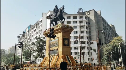
Maharana Pratap Chowk, Rohini is one of the most prominently positioned and popularly referenced neighbourhood intersections within Delhi’s largest planned residential township, carrying the name of Maharana Pratap Singh — the legendary Rajput warrior king of Mewar whose fierce resistance against Mughal expansion and whose symbol of uncompromising independence has made him one of the most revered figures in North Indian historical consciousness. In a township as large and diverse as Rohini — housing over a million residents from across India’s northern states — the choice of Maharana Pratap’s name for a central chowk reflects both the Rajput community’s significant presence among Rohini’s residential population and the broader North Indian reverence for a hero who embodies the values of courage, self-sacrifice, and principled resistance that transcend any single community’s boundaries.
The chowk serves as a daily commercial and transit hub for one of Rohini’s most populated sector zones, surrounded by the neighbourhood market ecosystem, educational institutions, healthcare facilities, banks, and service businesses that sustain the daily life of a large planned colony community. Rohini’s scale means that individual chowks like Maharana Pratap carry enormous daily footfall from the residential sectors immediately surrounding them, functioning as the primary commercial destinations for hundreds of thousands of residents whose daily shopping, banking, medical, and service needs are served within the chowk’s immediate catchment. For the working and middle-class families of the surrounding Rohini sectors, this chowk is the daily commercial and social anchor around which neighbourhood life organises itself.
| Detail | Information |
| Location | Maharana Pratap Chowk, Rohini, North-West Delhi |
| Type of Junction | Neighbourhood Commercial Intersection / Rohini Sector Hub |
| Primary Road | Rohini Sector Road / Outer Ring Road Connector |
| Nearest Metro Station | Rohini East / Rohini West — Delhi Metro Red Line |
| Key Roads Connected | Rohini Sector Roads, Outer Ring Road Connector, Rohtak Road, Pitampura Road |
| Distance from Connaught Place | Approx. 17–19 km |
| Distance from Pitampura | Approx. 5–6 km |
| Distance from Mukarba Chowk | Approx. 4–5 km |
| Distance from Netaji Subhash Place | Approx. 7–8 km |
| Governing Authority | North Delhi Municipal Corporation, DDA, DMRC |
| Nearby Landmarks | Rohini Sector Markets, AIIMS Rohini Campus vicinity, Crown Plaza Rohini |
| Public Transport Options | Delhi Metro Red Line, DTC Bus, App Cabs, Auto-Rickshaw |
| Best Suited For | Rohini residential sector daily commercial and transit corridor |
| Peak Traffic Hours | 9:00 AM – 11:30 AM and 5:30 PM – 9:00 PM |
Location of Maharana Pratap Chowk
Maharana Pratap Chowk is positioned within Rohini’s planned residential sector grid in North-West Delhi, at the junction of primary sector roads that connect some of the most densely populated sections of the township to the external arterial network. The chowk sits within the well-ordered spatial framework of DDA’s Rohini masterplan, at a point where the sector road grid creates a natural commercial node through the convergence of resident footfall from multiple surrounding sectors. The commercial activity at the chowk reflects the socioeconomic character of Rohini’s residential population — primarily working and middle-class families in government service, business, and the trades — with neighbourhood markets offering daily essentials, clothing, electronics, and food at price points suited to a large price-sensitive residential community.
Directions to Maharana Pratap Chowk
From Connaught Place: Travel northward from Connaught Place via the Outer Ring Road or GT Karnal Road heading toward the northwestern residential belt. Continue through Ashok Vihar and Pitampura toward the Rohini sector road network. Maharana Pratap Chowk is approximately 17 to 19 kilometres from Connaught Place with a travel time of 40 to 60 minutes through the northwestern Delhi arterial system, or considerably faster via the Red Line metro to the nearest Rohini station.
From Pitampura: Travel northward from Pitampura’s Madhuban Chowk commercial zone via the connecting roads heading into the Rohini residential belt. The chowk is approximately 5 to 6 kilometres from Pitampura’s central area with a travel time of 15 to 25 minutes through the residential road network connecting these two important northwest Delhi zones.
From Mukarba Chowk: Travel westward from Mukarba Chowk via the connecting road network heading into Rohini’s sector grid. Maharana Pratap Chowk is approximately 4 to 5 kilometres from Mukarba Chowk with a travel time of 15 to 20 minutes — one of the more direct approaches from the Ring Road’s major northern junction.
From Rohini Metro Stations: Exit either Rohini East or Rohini West Metro Station on the Red Line and travel a short distance via the sector roads toward the Maharana Pratap Chowk commercial zone. The junction is within easy auto-rickshaw or walking distance from these stations, making the metro approach the most practical public transport option for daily commuters.
From Netaji Subhash Place: Travel northward from the NSP commercial and metro interchange complex via the Pitampura connector roads heading into the Rohini sector belt. Maharana Pratap Chowk is approximately 7 to 8 kilometres from NSP with a travel time of 20 to 30 minutes through the northwest Delhi road network.
Metro and Public Transport Connectivity
The Delhi Metro Red Line’s Rohini East and Rohini West stations are the primary public transport access points for Maharana Pratap Chowk, providing direct Red Line connectivity southward through Pitampura, Kohat Enclave, Netaji Subhash Place, and toward the interchange at Inderlok with the Green Line, and northward toward Rithala. The Red Line has been transformative for Rohini’s enormous commuter population, enabling daily journeys to Central Delhi employment that previously required hour-long bus journeys. DTC buses operate high-frequency services along the GT Karnal Road and the Rohini sector connector roads, serving the residential sectors surrounding the chowk with multiple route options toward Connaught Place, Chandni Chowk, and the broader Delhi bus network. Auto-rickshaws serve the intra-sector short-trip needs of Rohini’s residential population throughout the day and evening.
Road Connectivity
- Rohini Sector Roads form the primary planned road network connecting all Rohini residential sectors to the chowk and external arterials.
- Outer Ring Road Connector provides access to the circumferential Ring Road network linking Rohini to Wazirpur, Azadpur, and Delhi’s arterial ring.
- Rohtak Road extends westward toward Nangloi, Bahadurgarh, and the western Delhi-Haryana corridor.
- Pitampura Road connects southward toward the Pitampura commercial and metro corridor.
Nearby Areas and Neighbourhoods
Rohini Sectors 9, 10, 11, and 13: The residential sectors immediately surrounding Maharana Pratap Chowk are among Rohini’s most densely populated, housing a predominantly working and lower-middle-class population of government employees, factory workers, traders, and service sector professionals in DDA flats and plotted developments that represent the characteristic built environment of Delhi’s planned residential townships.
AIIMS Rohini Campus: The new All India Institute of Medical Sciences campus established in Rohini adds significant institutional weight to the broader chowk catchment, generating healthcare visitor traffic and medical professional commuting that will increasingly shape the junction’s daily activity as the campus reaches full operational capacity.
Crown Plaza Area: The commercial and entertainment development near the Rohini zone is accessible from Maharana Pratap Chowk via the sector roads and represents the kind of premium retail and entertainment infrastructure that serves Rohini’s enormous residential population for leisure and lifestyle needs.
Budh Vihar and Vijay Vihar: Densely populated residential localities adjacent to the Rohini sector grid that are directly connected to the Maharana Pratap Chowk zone via the connecting road network, contributing a large additional residential population to the chowk’s daily commercial catchment.
Sector 24 and Sector 25 Rohini: Well-established Rohini sectors adjacent to the chowk zone offering the kind of mature civic infrastructure — reputed schools, local hospitals, established markets — that has developed over three decades of continuous residential occupation and community building within Rohini’s planned township framework.
Frequently Asked Questions (FAQs)
Q1. Where is Maharana Pratap Chowk located in Rohini Delhi?
Maharana Pratap Chowk is in the Rohini planned residential township of North-West Delhi, approximately 17 to 19 kilometres from Connaught Place within the Rohini sector road grid.
Q2. Which metro stations serve Maharana Pratap Chowk Rohini?
Rohini East and Rohini West on the Delhi Metro Red Line are the nearest stations, providing direct connectivity to Pitampura, Netaji Subhash Place, and Central Delhi.
Q3. Who is Maharana Pratap Chowk named after?
The chowk is named after Maharana Pratap Singh, the legendary Rajput warrior king of Mewar who is revered across North India for his fierce resistance against Mughal expansion and his embodiment of courage and independence.
Q4. How far is Maharana Pratap Chowk from Pitampura?
Pitampura’s commercial zone is approximately 5 to 6 kilometres from Maharana Pratap Chowk Rohini via the connecting residential road network.
Q5. What institutional development near Maharana Pratap Chowk is significant?
The new AIIMS Rohini campus near the chowk zone adds major institutional healthcare significance to this part of Rohini, with growing impact on the daily traffic and commercial character of the surrounding area.