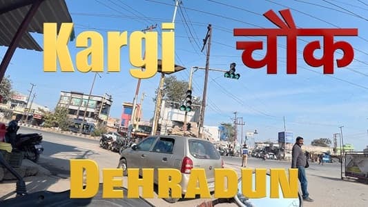
Dehradun has a way of making even its busiest junctions feel slightly unhurried — the tree cover helps, the moderate climate helps, and the fact that this city never fully surrendered to the urban chaos that consumed most Indian state capitals certainly helps. Kargi Chowk sits along the Haridwar Road corridor in the southern part of the city, at a junction where the daily traffic of a capital city going about its business meets the through-traffic of travelers moving between Dehradun and the pilgrim cities of the Ganga valley. It is a working junction with a specific geographic logic — vehicles heading toward Haridwar, Rishikesh, and the Char Dham pilgrimage circuit pass through here, as do the daily commuters of the southern Dehradun residential belt.
The name Kargi connects to the broader Kargi area of Dehradun — a zone that has been developing steadily as the city has expanded southward, drawing residential investment from families seeking larger homes than the older city neighborhoods typically offer. The chowk itself has the functional, moderately busy character of a junction that matters more for where it connects to than for what immediately surrounds it, which makes understanding those connections particularly important for anyone navigating Dehradun’s southern approach roads.
| Detail | Information |
| Location | Kargi Chowk, South Dehradun, Uttarakhand |
| Primary Road | Haridwar Road (NH-58) / Kargi Road |
| Nearest Railway Station | Dehradun Railway Station — Approx. 6–8 km |
| Nearest Airport | Jolly Grant Airport — Approx. 25–28 km |
| Key Roads Connected | Haridwar Road (NH-58), Kargi Road, Balliwala Road, Saharanpur Road |
| Distance from Clock Tower | Approx. 5–6 km |
| Distance from ISBT Dehradun | Approx. 4–5 km |
| Distance from Haridwar | Approx. 50 km via NH-58 |
| Distance from Rishikesh | Approx. 45 km |
| Governing Authority | Dehradun Municipal Corporation, Uttarakhand PWD, NHAI |
| Nearby Landmarks | Kargi Grant area, Balliwala Chowk vicinity, Southern Dehradun residential belt |
| Public Transport Options | GMOU Bus, City Bus, Vikram Tempo, App Cabs |
| Peak Traffic Hours | 8:30 AM – 11:00 AM and 4:30 PM – 8:00 PM |
Location
Kargi Chowk is positioned along the NH-58 Haridwar Road corridor in southern Dehradun, at the junction where this important national highway artery meets the internal roads feeding into the Kargi and surrounding residential localities. The Haridwar Road is one of Dehradun’s busiest arterials year-round but transforms into something else entirely during pilgrimage season — the volume of buses, shared jeeps, and private vehicles heading toward Haridwar and Rishikesh can be extraordinary during the major festival periods, and Kargi Chowk sits directly in the path of all of it.
Directions
From Dehradun Clock Tower: Travel southward along the primary city arterials connecting to Haridwar Road. Continue approximately 5 to 6 kilometres toward the southern zone. Travel time is 15 to 25 minutes under normal city traffic conditions — somewhat longer if the ISBT bus traffic on the southern approach is heavy.
From Dehradun ISBT: The Inter-State Bus Terminal is roughly 4 to 5 kilometres from Kargi Chowk. Exit the ISBT and head southward along Haridwar Road. Vikram tempos and city buses cover this stretch regularly throughout the day.
From Jolly Grant Airport: Exit the airport via NH-58 heading westward toward the city. Continue along the national highway — Kargi Chowk is encountered along this route approximately 25 to 28 kilometres from the airport. Travel time is 45 to 60 minutes.
From Haridwar: Travel northward on NH-58 from Haridwar heading toward Dehradun. The highway leads directly to Kargi Chowk as one of the first significant junctions encountered upon entering the city’s southern boundary from the Haridwar direction. About 50 kilometres, 70 to 90 minutes.
From Mussoorie: Descend from Mussoorie via Rajpur Road and continue through the city center toward the southern zone. Connecting from the Clock Tower area southward to Kargi Chowk covers approximately 10 to 12 kilometres total from Mussoorie with a travel time of 60 to 80 minutes including the mountain descent.
Public Transport Connectivity
The Vikram tempo is the soul of Dehradun’s public transport and operates extensively through the Haridwar Road corridor serving Kargi Chowk. These shared three-wheelers follow fixed routes that Dehradun residents know intuitively and use practically daily. GMOU city buses also serve this corridor. The important thing to know about Kargi Chowk from a transport perspective is its position on NH-58 — virtually every bus heading between Dehradun and Haridwar or Rishikesh passes through or near this junction, making it an inadvertent long-distance transport node in addition to its city-level function. App-based cabs are increasingly popular in Dehradun, particularly among the younger professional population and tourists visiting the hill station.
Nearby Areas
Kargi Grant: The broader Kargi area has been developing as a residential zone attracting families seeking larger plots and quieter living within Dehradun’s city limits. The residential character here is more spacious than the older city neighborhoods, with independent houses and newer housing colonies that represent Dehradun’s southward residential expansion.
Balliwala: The adjacent Balliwala area and its chowk are directly connected to the Kargi zone and together form the southern Dehradun transit and residential belt that serves commuters moving between the inner city and the Haridwar Road corridor.
Doiwala Road Corridor: The semi-urban corridor extending southward toward Doiwala along NH-58 beyond Kargi Chowk represents the agricultural and residential fringe of greater Dehradun — small towns, educational institutions, and the Doon Valley’s characteristic mix of managed and forested land that makes this geography genuinely beautiful.
Southern Dehradun Residential Projects: Several newer residential developments have been coming up in the Kargi and adjacent southern zone, attracted by the relatively lower land prices compared to central Dehradun localities and the improving road connectivity that NH-58’s quality provides.
Haridwar Road Commercial Belt: The commercial establishments along Haridwar Road near Kargi Chowk serve both the local residential population and the constant stream of pilgrims and tourists heading toward the Char Dham circuit — a dual commercial dynamic that gives this stretch a slightly different energy from purely residential neighbourhood markets.
Frequently Asked Questions (FAQs)
Q1. Where is Kargi Chowk in Dehradun?
Southern Dehradun, on the Haridwar Road (NH-58) corridor, approximately 5 to 6 kilometres from the Clock Tower city centre.
Q2. How far is Kargi Chowk from Haridwar?
Roughly 50 kilometres via NH-58, taking 70 to 90 minutes by road.
Q3. What public transport is available at Kargi Chowk?
Vikram tempos, GMOU city buses, and app-based cabs. Most Haridwar and Rishikesh-bound buses pass through or near this corridor.
Q4. How far is Kargi Chowk from Jolly Grant Airport?
About 25 to 28 kilometres via NH-58, taking 45 to 60 minutes.
Q5. Is Kargi Chowk on the Haridwar highway?
Yes, NH-58 connecting Dehradun to Haridwar passes through the Kargi Chowk zone, making it a natural stopping point for highway traffic in both directions.