Only in Delhi would a neighbourhood name its central junction after a deep-fried sweet. Jalebi Chowk in Sultanpuri carries that name with the unself-conscious confidence of a working-class locality that has never needed to brand itself or market its identity to anyone. The name likely came from a jalebi stall that once stood at this crossing — or perhaps still does — and stuck the way these things stick in Indian neighbourhoods, through daily repetition in auto-rickshaw directions and mobile phone calls until the name becomes more real than whatever the official map says.
Sultanpuri is outer Northwest Delhi at its most honest. This is not the polished Rohini of DDA planning charts. It is a dense, living, breathing colony that grew because people needed somewhere affordable to live within reach of Delhi’s employment zones, and it has the particular vitality of places that develop organically under genuine necessity rather than master planning. The market around Jalebi Chowk operates with that same organic logic — it exists because a large population needs it to, not because a developer built a commercial podium below a residential tower.
| Detail | Information |
| Location | Jalebi Chowk, Sultanpuri, North-West Delhi |
| Primary Road | Sultanpuri Main Road / Outer Ring Road Connector |
| Nearest Metro Station | Sultanpur — Delhi Metro Green Line |
| Key Roads Connected | Sultanpuri Road, Mangolpuri Road, Mundka Road, Outer Ring Road |
| Distance from Connaught Place | Approx. 18–20 km |
| Distance from Mundka | Approx. 3–4 km |
| Distance from Mangolpuri | Approx. 3–4 km |
| Governing Authority | North Delhi Municipal Corporation, PWD Delhi |
| Nearby Landmarks | Sultanpuri Market, Industrial Area Mundka, Mangolpuri Colony |
| Public Transport Options | Delhi Metro Green Line, DTC Bus, Shared Auto, App Cabs |
| Peak Traffic Hours | 8:00 AM – 10:30 AM and 5:30 PM – 9:00 PM |
Location
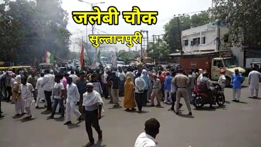
Jalebi Chowk sits inside the Sultanpuri residential colony of North-West Delhi, at a junction where the main colony road meets the arterials connecting toward Mangolpuri and the Outer Ring Road. Sultanpuri itself is one of those Delhi colonies that official planning documents acknowledge but rarely celebrate — a densely populated resettlement area that has developed its own complete commercial ecosystem through decades of community building. The chowk is the colony’s primary commercial reference point, the place residents give when directing anyone to anywhere in Sultanpuri.
Directions
From Connaught Place: Take the Green Line metro from any central Delhi station toward Inderlok and continue to Sultanpur Station. That handles 90 percent of the journey. By road, travel northwestward via the Outer Ring Road through Wazirpur and connect toward Sultanpuri — about 18 to 20 kilometres, 40 to 60 minutes.
From Mundka Metro Station: Mundka is 3 to 4 kilometres away on the Blue Line. From there, shared autos and autos run toward Sultanpuri regularly. Travel time is 10 to 15 minutes.
From Mangolpuri: The two colonies share a road connection that makes this a short 3 to 4 kilometre journey, 10 to 15 minutes by auto-rickshaw through the residential road network.
From Rohtak Road: Enter from Nangloi direction along Rohtak Road and connect northward toward Sultanpuri via the colony access roads. About 6 to 8 kilometres, 15 to 25 minutes.
Metro and Public Transport Connectivity
Sultanpur Metro Station on the Green Line is the nearest rail connection, linking Jalebi Chowk’s catchment southward through Mangolpuri, Paschim Vihar, and Rajouri Garden toward the Blue Line interchange, and northward toward Brigadier Hoshiyar Singh. DTC buses serve the Sultanpuri corridor along multiple routes. The real daily transport at Jalebi Chowk, though, is the shared auto — these run toward the metro station, toward Mundka, toward Mangolpuri Industrial Area, and toward Rohtak Road in a constant informal network that most residents use by instinct rather than by timetable.
Nearby Areas
Mangolpuri Industrial Area: The significant manufacturing zone east of Sultanpuri employs a large portion of Jalebi Chowk’s residential catchment, and the morning shift traffic from colony to factory gate is one of the defining daily rhythms of this junction.
Mundka: The Blue Line metro station at Mundka and its surrounding commercial zone is the nearest larger commercial destination for Sultanpuri residents, connected to Jalebi Chowk via the colony road network.
Sultanpuri Market: The dense commercial strip surrounding the chowk is the colony’s primary shopping destination — vegetables, clothing, mobile repair, medical shops, and a dozen different types of street food operating simultaneously in the compact commercial energy of a large working-class colony market.
Pooth Kalan: An adjacent residential and light industrial locality connected to Jalebi Chowk via the northwestern Delhi road network, with a population that shares the commercial and transit infrastructure of the broader Sultanpuri zone.
Frequently Asked Questions (FAQs)
Q1. Where is Jalebi Chowk located in Delhi?
Inside Sultanpuri colony, North-West Delhi, approximately 18 to 20 kilometres from Connaught Place.
Q2. How did Jalebi Chowk get its name?
Almost certainly from a jalebi sweet stall that once operated at this junction — the name stuck through neighbourhood usage and is now permanently embedded in local navigation.
Q3. Which metro serves Jalebi Chowk?
Sultanpur Station on the Green Line is the nearest, a short auto-rickshaw ride from the chowk.
Q4. What is the main commercial activity at Jalebi Chowk?
A dense neighbourhood market serving daily needs — groceries, clothing, street food, and services for Sultanpuri’s large residential population.
Q5. How far is Jalebi Chowk from Mangolpuri?
About 3 to 4 kilometres, accessible in 10 to 15 minutes via the colony connecting roads.