 By Saurav Mehra
 Ballupur Chowk, Dehradun, Uttarakhand is one of the most important and commercially vibrant urban intersections in the capital city of Uttarakhand, serving as a primary daily commercial and transit reference point for the large residential population of the Ballupur locality and the broader southern Dehradun residential and institutional belt. Located along one of Dehradun’s most important arterial road corridors, this chowk has developed into a genuinely significant neighbourhood hub whose commercial ecosystem — banks, retail establishments, restaurants, coaching institutes, medical facilities, and the dense local market activity — reflects the diverse daily needs of a capital city population that includes government employees, defence personnel, students, business owners, retirees, and the growing corporate professional community that has been attracted to Dehradun by its improving infrastructure and exceptional quality of life.
Dehradun carries a very specific quality that distinguishes it from most Indian state capitals. Nestled in the Doon Valley between the Himalayan foothills and the Shivalik range, surrounded by rivers and forests, blessed with a moderate hill climate that makes it one of India’s more liveable cities, and enriched by the presence of some of India’s most prestigious educational and military institutions — IMA, RIMC, Doon School, FRI, ONGC headquarters — the city combines institutional gravitas with natural beauty in a combination that most capitals can only envy. Ballupur Chowk sits within this privileged urban context, serving as the commercial anchor for a zone that benefits from proximity to both the prestigious residential addresses of South Dehradun and the institutional establishments that define the city’s character. For the military officers, IAS trainees, school headmasters, scientists, business owners, and retired civil servants who form a significant part of the Ballupur catchment population, this chowk is the daily commercial and social meeting point of an unusually accomplished urban community.
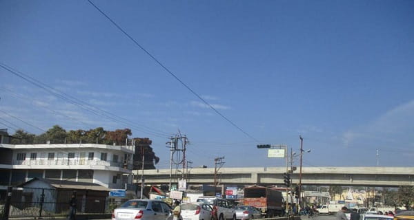
Ballupur Chowk Overview
| Detail | Information |
| Location | Ballupur Chowk, Dehradun, Uttarakhand |
| Type of Junction | Residential and Commercial Intersection / South Dehradun Hub |
| Primary Road | Ballupur Road / GMS Road (Govind Ballabh Pant Marg) |
| Nearest Railway Station | Dehradun Railway Station — Approx. 5–7 km |
| Nearest Airport | Jolly Grant Airport — Approx. 28–32 km |
| Key Roads Connected | Ballupur Road, GMS Road, Race Course Road, Canal Road |
| Distance from Clock Tower | Approx. 4–5 km |
| Distance from ISBT Dehradun | Approx. 5–7 km |
| Distance from Mussoorie | Approx. 32–35 km via Rajpur Road |
| Distance from Haridwar | Approx. 55 km via NH-58 |
| Governing Authority | Dehradun Municipal Corporation, Uttarakhand PWD, NHAI |
| Nearby Landmarks | GMS Road Commercial Belt, IMA Vicinity, Doon School Area, FRI Zone |
| Public Transport Options | UPSRTC/GMOU Bus, City Bus, App Cabs, Vikram Tempo |
| Best Suited For | South Dehradun residential and institutional corridor daily traffic |
| Peak Traffic Hours | 9:00 AM – 11:30 AM and 5:00 PM – 8:30 PM |
Location of Ballupur Chowk
Ballupur Chowk is geographically positioned in the Ballupur area of southern Dehradun, at the junction of Ballupur Road and the GMS Road (Govind Ballabh Pant Marg) — one of Dehradun’s most important commercial arterials that runs through the city’s southern residential and educational zone. The chowk sits within the broader South Dehradun institutional and residential belt whose character is defined by the presence of some of India’s most prestigious institutions — the Indian Military Academy, the Forest Research Institute, the Wildlife Institute of India, and several prestigious schools — giving this part of the city an unusually accomplished and institutionally rich character. The surrounding area has a comfortable, tree-lined quality that reflects both Dehradun’s hill city geography and the well-maintained character of a zone that has served an elite institutional population for generations.
Directions to Ballupur Chowk
From Clock Tower (City Centre): Travel southward from Dehradun’s iconic Clock Tower along the primary city arterials heading toward the southern residential belt. Continue through the commercial zone toward GMS Road and the Ballupur area approximately 4 to 5 kilometres from the Clock Tower with a travel time of 15 to 25 minutes through Dehradun’s moderately congested city center traffic.
From Dehradun Railway Station: Exit the station and travel southward via the station approach roads connecting to the main city arterials. Continue toward the southern residential zone and approach Ballupur Chowk approximately 5 to 7 kilometres from the station with a travel time of 20 to 30 minutes.
From Jolly Grant Airport: Exit the airport and take the airport approach road heading toward the city via NH-58. Continue through the Doiwala and Rishikesh Road approach and head toward the city center and then southward toward Ballupur. Total distance from the airport is approximately 28 to 32 kilometres with a travel time of 50 to 70 minutes.
From Mussoorie: Travel southward from Mussoorie along Rajpur Road heading toward Dehradun city center. Continue through the commercial zone and head toward the southern residential belt and Ballupur Chowk approximately 32 to 35 kilometres from Mussoorie’s central zone with a travel time of 50 to 70 minutes through the mountain road descent.
From Haridwar: Travel northward along NH-58 from Haridwar heading toward Dehradun. Continue through the Doiwala corridor and into the city. Head toward the southern residential zone and approach Ballupur Chowk approximately 55 kilometres from Haridwar with a travel time of 70 to 90 minutes.
Public Transport Connectivity
Dehradun does not have a metro rail system and relies on a combination of GMOU buses, city bus services, Vikram shared tempos — the iconic three-wheelers that have been a hallmark of Dehradun’s public transport for decades — and app-based cabs for daily urban mobility. GMOU and Uttarakhand Transport Corporation buses operate routes through the GMS Road and Ballupur corridor connecting the chowk to the Clock Tower, ISBT, railway station, and other city destinations. The Vikram tempos that operate on fixed routes throughout Dehradun provide the most affordable and characteristically Dehradun public transport experience for the city’s residents, navigating the hill city’s roads with the local knowledge that makes them practical for residents who know the routes. App-based cabs have seen strong adoption among Dehradun’s growing corporate and institutional professional population for point-to-point comfortable travel.
Road Connectivity
- Ballupur Road runs through the locality’s primary residential and commercial spine connecting the chowk to the broader South Dehradun road network.
- GMS Road (Govind Ballabh Pant Marg) extends as one of Dehradun’s most important commercial arterials connecting South Dehradun to the city center.
- Race Course Road connects toward the prestigious Race Course residential and institutional zone.
- Canal Road extends toward the Eastern Canal Road corridor — one of Dehradun’s most important green arterials running alongside the historic irrigation canal.
Nearby Areas and Neighbourhoods
GMS Road Commercial Belt: The busy commercial strip along Govind Ballabh Pant Marg accessible from Ballupur Chowk is one of South Dehradun’s most active retail and dining corridors, offering restaurants, retail shops, coaching centers, banks, and medical facilities that serve the large residential population of the southern institutional belt.
IMA (Indian Military Academy) Vicinity: The Indian Military Academy — one of India’s most prestigious officer training establishments — is located in the South Dehradun zone accessible from Ballupur Chowk, and the military community associated with IMA contributes a significant and distinctive institutional population to this part of the city’s residential and commercial catchment.
Forest Research Institute Zone: The magnificent FRI campus — one of India’s most beautiful institutional buildings in the colonial Gothic style, surrounded by extensive forest cover — is accessible from the Ballupur corridor and represents perhaps the most visually extraordinary institutional landmark in Dehradun’s urban landscape.
Doon School Area: The legendary Doon School — India’s most prestigious boarding school whose alumni list reads like a who’s who of Indian public life — is accessible from the Ballupur Chowk zone and adds an elite educational dimension to the institutional character of this South Dehradun residential belt.
Karanpur and New Cantt Road: Established residential localities connected to Ballupur Chowk via the South Dehradun road network, offering comfortable mid-to-premium residential options for Dehradun’s government service and corporate professional population within the city’s most desirable southern residential zone.
Frequently Asked Questions (FAQs)
Q1. Where is Ballupur Chowk located in Dehradun?
A: Ballupur Chowk is in the Ballupur area of southern Dehradun, Uttarakhand, on the GMS Road corridor, approximately 4 to 5 kilometres from Dehradun’s Clock Tower city centre.
Q2. How far is Ballupur Chowk from Jolly Grant Airport?
A: Jolly Grant Airport is approximately 28 to 32 kilometres from Ballupur Chowk with a travel time of 50 to 70 minutes by road.
Q3. What prestigious institutions are near Ballupur Chowk Dehradun?
A: The Indian Military Academy (IMA), Forest Research Institute (FRI), and the Doon School are the most prominent prestigious institutional landmarks accessible from the Ballupur Chowk zone.
Q4. Is there metro connectivity at Ballupur Chowk Dehradun?
A: Dehradun does not have a metro system. GMOU buses, city buses, Vikram tempos, and app-based cabs provide public transport at this junction.
Q5. How far is Ballupur Chowk from Mussoorie?
A: Mussoorie is approximately 32 to 35 kilometres from Ballupur Chowk via Rajpur Road, with a travel time of 50 to 70 minutes through the mountain road descent.