 By Saurav Mehra
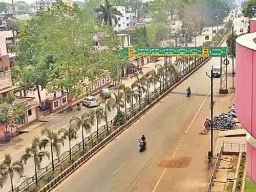
 Chhattisgarh’s cities carry an unhurried quality that the faster-paced metros have long since lost. Raipur — the state capital carved out of Madhya Pradesh when Chhattisgarh became India’s 26th state in 2000 — has been growing steadily and purposefully without the panic-mode urbanization that characterizes cities under extreme population pressure. Nehru Chowk in Raipur is the kind of central city junction that most Indian state capitals have at their civic heart — named after the first Prime Minister as a post-independence act of political naming that became permanent through daily usage, positioned at a point that makes navigational sense, and surrounded by the commercial and institutional activity of a city organized around government, agriculture, and the steel and mining economy of one of India’s most mineral-rich states.
There is something fitting about a Nehru Chowk being a genuine daily focal point in Chhattisgarh. The state’s identity was shaped by the Nehruvian industrial vision more literally than most — the Bhilai Steel Plant, established under the public sector heavy industry framework that Nehru championed, remains one of the most significant economic anchors in the state’s economy seven decades after its establishment. The workers, engineers, and families whose lives were organized around that industrial project are part of the social fabric that daily junctions like Nehru Chowk serve. The name is not just a civic formality here — it connects to something real in the region’s industrial history.
| Detail | Information |
| Location | Nehru Chowk, Raipur, Chhattisgarh |
| Type of Junction | Central Commercial Intersection / State Capital Civic Hub |
| Primary Road | GE Road (Great Eastern Road) / Nehru Chowk Road |
| Nearest Railway Station | Raipur Railway Station — Approx. 2–4 km |
| Nearest Airport | Swami Vivekananda Airport — Approx. 14–16 km |
| Key Roads Connected | GE Road, Jail Road, Fafadih Road, Pachpedi Naka Road |
| Distance from Pachpedi Naka | Approx. 4–5 km |
| Distance from Bhilai | Approx. 28–30 km via NH-53 |
| Distance from Bilaspur | Approx. 110 km via NH-130 |
| Governing Authority | Raipur Municipal Corporation, Chhattisgarh PWD, NHAI |
| Nearby Landmarks | Nehru Market, Budha Talab vicinity, Raipur Railway Station zone |
| Public Transport Options | CG SRTC Bus, City Bus, App Cabs, Auto-Rickshaw |
| Peak Traffic Hours | 9:30 AM – 12:30 PM and 5:00 PM – 9:00 PM |
Location
Nehru Chowk is in the heart of Raipur’s main commercial zone, positioned along the GE Road — the Great Eastern Road that functions as the city’s primary commercial spine — at the intersection connecting the railway station approach to the broader city road network. GE Road is Raipur’s most commercially active street and Nehru Chowk anchors one of its busiest sections, surrounded by wholesale and retail establishments, government offices, hotels, and the commercial activity of a state capital whose traders serve not just the city but the entire Chhattisgarh agricultural and mineral hinterland.
Raipur is a trading city at its core. The rice mills, iron ore traders, and agricultural produce merchants whose commercial activity drives the city’s economy have always needed accessible central junctions for their daily transactions, and Nehru Chowk has historically served that function alongside its role as a daily residential commuter junction.
Directions
From Raipur Railway Station: Exit the station and the chowk is essentially around the corner — 2 to 4 kilometres through the station approach road connecting to GE Road. Auto-rickshaws make this journey in 10 to 20 minutes.
From Swami Vivekananda Airport: Travel southward from the airport toward the city center via the airport road connecting to the main city arterials. Nehru Chowk is approximately 14 to 16 kilometres from the airport, 30 to 45 minutes by road or app cab.
From Pachpedi Naka: Head northward from Pachpedi Naka — one of Raipur’s important southern commercial junctions — toward the city center along the connecting roads. About 4 to 5 kilometres, 15 to 20 minutes.
From Bhilai: Travel eastward from Bhilai along NH-53 heading toward Raipur. Continue into the city and approach the central commercial zone. Total distance is approximately 28 to 30 kilometres with a travel time of 40 to 55 minutes.
From Bilaspur: Travel southward from Bilaspur along NH-130 toward Raipur. Continue approximately 110 kilometres through the Chhattisgarh highway corridor. Enter Raipur from the northern approach and head toward the central commercial zone. Travel time is approximately 2 to 2.5 hours.
Public Transport Connectivity
Raipur does not have a metro rail system. The city’s public transport relies on Chhattisgarh State Road Transport Corporation buses, private city buses, and the auto-rickshaws that remain the dominant intra-city transport mode across Raipur’s commercial and residential zones. CG SRTC connects Raipur to Bhilai, Bilaspur, Jagdalpur, Durg, and other Chhattisgarh destinations from the main bus stand. Raipur Railway Station — one of the busiest on the Howrah-Mumbai rail corridor — provides excellent long-distance rail connectivity to Kolkata, Mumbai, Nagpur, and across the country. The station’s proximity to Nehru Chowk makes the rail-to-city-center transition unusually convenient. App-based cabs have seen strong adoption in Raipur’s professional and government employee population.
Nearby Areas
Nehru Market: The commercial market zone directly associated with the chowk is one of Raipur’s most active wholesale and retail destinations, serving the full range of daily commercial needs for the city’s large trading and residential population. Textile wholesale, hardware, electronics, and daily essentials concentrate in the streets radiating from this junction.
Budha Talab: One of Raipur’s most important civic landmarks — a large urban lake that has been the recreational and cultural center of the city for generations — is accessible from the Nehru Chowk zone and provides the city with a natural heritage space that gives Raipur a specific urban character that purely commercial cities lack.
GE Road Commercial Strip: The Great Eastern Road running through Nehru Chowk is Raipur’s primary commercial artery, lined with hotels, banks, wholesale traders, and the full commercial diversity of a state capital’s main street. The concentration of commercial activity here is genuine and sustained.
Durg: The important industrial and commercial city of Durg forms a near-continuous urban belt with Raipur and Bhilai, collectively creating the Raipur-Durg-Bhilai metropolitan corridor that is Chhattisgarh’s primary urban economic zone. Nehru Chowk serves as the Raipur end of this corridor’s central city commercial infrastructure.
Pandri and Shankar Nagar: Established residential localities of Raipur accessible from Nehru Chowk via the city road network, offering mid-to-premium residential options for the state capital’s government service and professional population.
Frequently Asked Questions (FAQs)
Q1. Where is Nehru Chowk in Chhattisgarh?
A: Central Raipur, Chhattisgarh, on GE Road approximately 2 to 4 kilometres from Raipur Railway Station.
Q2. How far is Nehru Chowk from Bhilai?
A: Approximately 28 to 30 kilometres via NH-53, taking 40 to 55 minutes from Bhilai city.
Q3. Is there metro connectivity at Nehru Chowk Raipur?
A: Raipur does not have a metro system. CG SRTC buses, city buses, auto-rickshaws, and app-based cabs provide public transport coverage.
Q4. What is the nearest railway station to Nehru Chowk?
A: Raipur Railway Station is 2 to 4 kilometres away — one of the better railway-to-chowk proximity relationships among state capital civic junctions in central India.
Q5. What is Budha Talab and how far is it from Nehru Chowk?
A: Budha Talab is Raipur’s historic urban lake and recreational landmark, within the broader Nehru Chowk catchment zone and representing one of the city’s most valued civic natural assets.